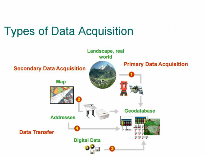
Data acquisition is the process of sampling signals that measure real world physical conditions and converting the resulting samples into digital numeric values that can be manipulated by a computer.I learned how to use a lot fo tools, such as snapping,georeferencing,vectorization,trace,point,geoprocessing(buffer,clip,overlap,intersect,dissolve,merge and etc.).Used a lot of arctoolbox tools,went through a lot of spatial analysis.
Below some information about my work
i worked for a few weeks with gps,i was collecting data from everything(trees,roads,fields,signs,hatches) to transfer it to the arcmap and connect to my map.Let's talk about gps.
|
|
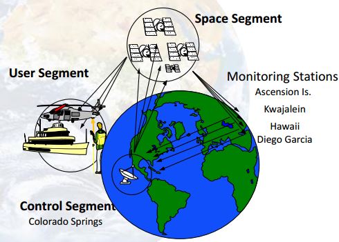
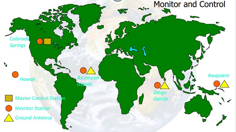
Control segment
Common uses of gps
Data Acquisition :
+ Surveying
+ Mapping
+ Data Collection
Navigation:
+ Land, Sea and Air Navigation
+ Tracking
Agriculture:
+ Fertilizer/water…
Military Applications
+ Target acquisition and
destruction:
+ Missile Guidance Systems
+ Search and Rescue
How is gps working?
„It‘s a measurement of time the signal needs to run from the
satellite the the receiver“
Distance = Rate x Time
Rate = 186,000 miles per
second (Speed of Light)
- Time = time it takes signal
to travel from the SV to
GPS receiver
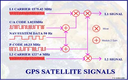
used signas
Common problems - errors
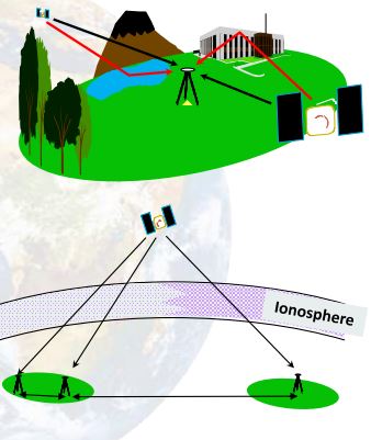
Multipath: Caused by local reflections
|
|
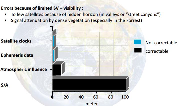
GPS – Type of errors
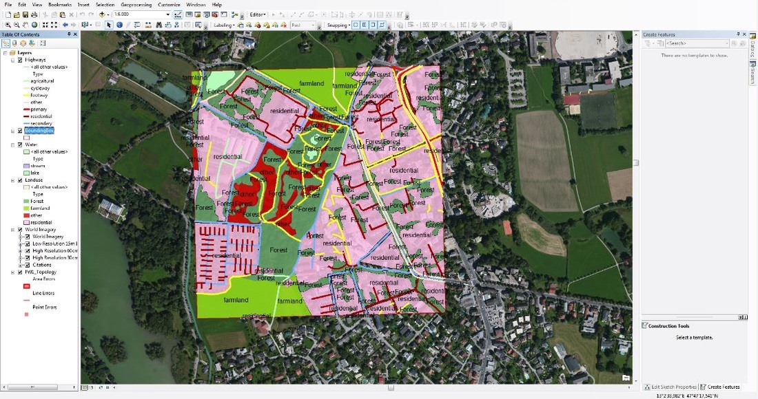
besides working with gps i digitaezed a territory of zalsburg,it's preaty hard to do that,and it takes a lot of time to be completed.
My awards