What is LiDAR?
LIGHT DETECTION AND RANGING
• IS AN ACTIVE REMOTE SENSING TECHNOLOGY
– MEASURES DISTANCE BY ILLUMINATING A
TARGET WITH A LASER AND ANALYZING THE
REFLECTED LIGHT
• SINCE 1960S (HUGHES AIRCRAFT INC.)
• TYPICALLY USED IN VERY ACCURATE MAPPING
OF TOPOGRAPHY
Why use a Laser?
•monochromatic – one specific wevelength of light
– we know how the particular wavelengths interact with the atmosphere and
materials
• directional – very narrow beam
– the beam does not lose its strength over long distances
– typically 3mrad divergence = 3 m @ 1 km
Types of LiDAR
• ALS – Airborne Laser Scanning
• TLS – Terrestrial Laser Scanning
• SLS – Spaceborne Laser Scanning
Aim of the LiDAR-based analysis
• to develop an OBIA-based automated classification procedure of ALS data
that would allow mapping of secondary forest succession on abandoned
lands
• central to our interest was agricultural land that was covered with
vegetation typical of secondary forest succession, particularly tall herb
communities, shrubs, bushes, and single young trees that progressively
occupy former arable land
ALS mapping concepts
|
|
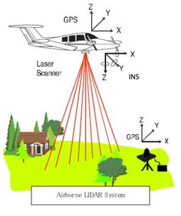
Basic ALS System Components
• laser – usually NIR –1064 nm
• rotating mirror / scanning
mechanism
• receiver – recording reflected
„returns”
• aircraft location system –
differential GPS and Inertial
Navigation System (INS, IMU)
• a very fast computer
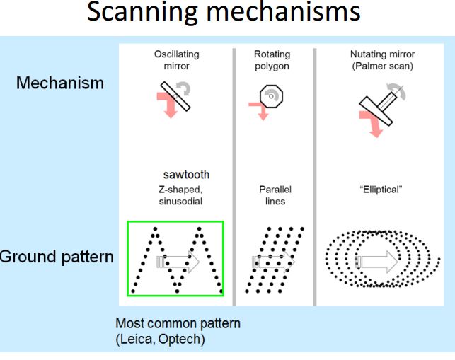
Scanning mechanisms
Two families of ALS systems
• full-waveform systems
– record the complete range of the energy pulse
• discrete-return systems
– sample the returned energy from each outgoing laser pulse in the vertical plane
(Z), if the return reflection is strong enough
Discrete-return LiDAR
|
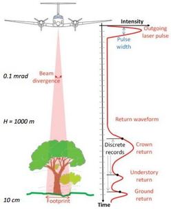
|
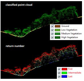
Multiple returns
Vegetataion penetration
|
|
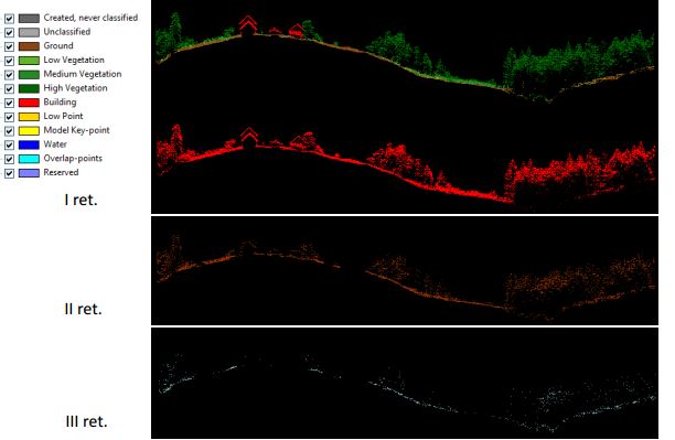
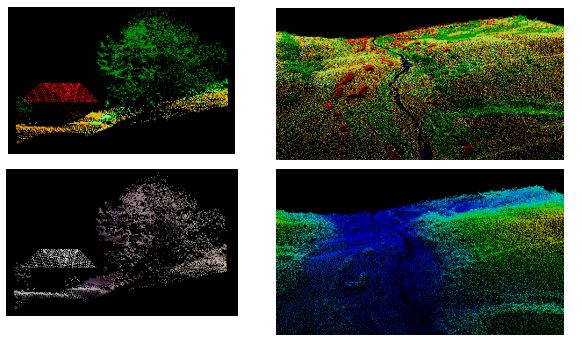
ALS point clouds
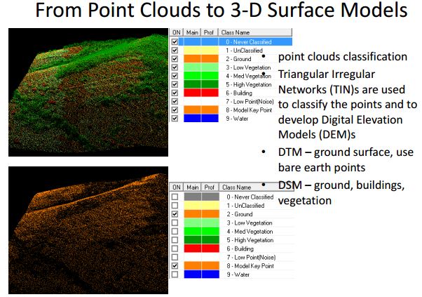
LiDAR surfacing